With Maps Comparison, you can compare and visualize up to 5 extended maps simultaneously in a single Virtual Photometric Lab session.
This tool allows you to optimize visual comparison of simulation results.
To use the Maps Comparison feature:
From Virtual Photometric Lab, load an extended map. The first extended map is always used as a primary map.
Click Tools > Maps Comparison...
Click Add reference maps to browse and load several maps to compare.
To better differentiate the maps, adjust the visualization parameters (curve pattern and curve thickness) for each
loaded map.
The curve pattern of the primary map cannot be changed and always appears solid.
When you have imported all the maps you want to compare in the session, click Compare.
The maps are displayed in
the viewer simultaneously.
If you want to save a comparison configuration, click save this set of references to export the current configuration in an .xml file. The configuration can then be re-imported in the viewer using the Load
option.
Only the reference maps are exported, not the primary map.
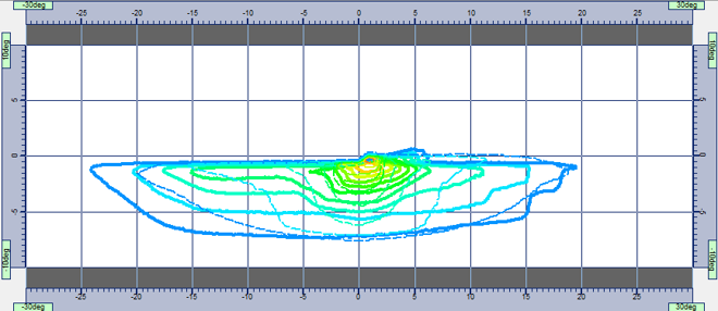
Figure 1. Example of comparison between a primary and a reference map.


_Add_Green.png) to browse and load several maps to compare.
to browse and load several maps to compare.  to export the current configuration in an .xml file. The configuration can then be re-imported in the viewer using the Load
 _Open.png) option.
option.